Filter by
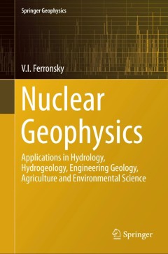
Nuclear Geophysics
The fundamentals of methods in nuclear geophysics and their practical applications in engineering geology, hydrology, hydrogeology, agriculture and environmental science are discussed in this book. The methods and apparatus based on absorption and scattering of gamma and neutron radiation for determination of density and soil moisture in natural conditions are presented in Chapters 2, 3, and …
- Edition
- 1
- ISBN/ISSN
- 978-3-319-12451-3
- Collation
- -
- Series Title
- Springer Geophysics
- Call Number
- -

Satellite Altimetry for Earth Sciences
Satellite altimetry is a radar technique for measuring the topography of the Earth’s surface. It was initially designed for measuring the ocean’s topography, with reference to an ellipsoid, and for the determination of the marine geoid. Satellite altimetry has provided extremely valuable information on ocean science (e.g., circulation surface geostrophic currents, eddy structures, wave heig…
- Edition
- -
- ISBN/ISSN
- 978-3-03897-681-3
- Collation
- -
- Series Title
- -
- Call Number
- 520 SAT

Magnetospheric Plasma Physics: The Impact of Jim Dungey’s Research
This book makes good background reading for much of modern magnetospheric physics. Its origin was a Festspiel for Professor Jim Dungey, former professor in the Physics Department at Imperial College on the occasion of his 90th birthday, 30 January 2013. Remarkably, although he retired 30 years ago, his pioneering and, often, maverick work in the 50’s through to the 70’s on solar terrestrial…
- Edition
- -
- ISBN/ISSN
- 978-3-319-18359-6
- Collation
- -
- Series Title
- -
- Call Number
- -
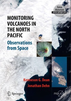
Monitoring Volcanoes in the North Pacific
This book provides a unique visual experience, showing satellite images of volcanic eruptions worldwide and detailed observations from the North Pacific ‘ring of fire’. Daily volcano monitoring and analysis from this region have resulted in one of the most detailed collections of satellite images in the world. An international team of experts has provided comprehensive cov…
- Edition
- 1
- ISBN/ISSN
- 978-3-540-24125-6
- Collation
- XXXIII, 363
- Series Title
- Springer Praxis Books
- Call Number
- -

Inverse Problems: Basics, Theory and Applications in Geophysics
The overall goal of the book is to provide access to the regularized solution of inverse problems relevant in geophysics without requiring more mathematical knowledge than is taught in undergraduate math courses for scientists and engineers. From abstract analysis only the concept of functions as vectors is needed. Function spaces are introduced informally in the course of the text, when needed…
- Edition
- -
- ISBN/ISSN
- 978-3-319-48384-9
- Collation
- -
- Series Title
- -
- Call Number
- -

Geological Storage of CO2 – Long Term Security Aspects
This book explores the industrial use of secure, permanent storage technologies for carbon dioxide (CO2), especially geological CO2 storage. Readers are invited to discover how this greenhouse gas could be spared from permanent release into the atmosphere through storage in deep rock formations. Themes explored here include CO2 reservoir management, caprock formation, bio-chemical processes and…
- Edition
- -
- ISBN/ISSN
- 978-3-319-13929-6
- Collation
- X, 245
- Series Title
- -
- Call Number
- 551 GEO
Active Volcanoes of Chiapas (Mexico): El Chichón and Tacaná
This publication summarizes the studies carried out at two of the most active volcanoes of Chiapas (Mexico): El Chichón and Tacaná. El Chichón erupted explosively in 1982 killing more than 2000 people being the worst volcanic disaster in Mexico, and Tacaná produced two mild phreatic explosions in 1950 and 1986. Only after these explosions a surge of new studies began to unreveal their volca…
- Edition
- Ed. 1
- ISBN/ISSN
- 978-3-642-25890-9
- Collation
- XI, 180
- Series Title
- Active Volcanoes of the World
- Call Number
- 551 ACT a

Studies of Historical Earthquakes in Southern Poland
This book examines old and new data on some of the 18th and 19th century earthquakes that either occurred or were clearly felt in southern regions of Poland. Particular emphasis is put on a detailed study and reinterpretation of the unusually severe Outer Western Carpathians earthquake on December 3, 1786 (7 I0, 5.3 Mw, 35 km depth), which was the last in a series of seismic events in the years…
- Edition
- -
- ISBN/ISSN
- 978-3-319-15446-6
- Collation
- XIII, 179
- Series Title
- GeoPlanet: Earth and Planetary Sciences
- Call Number
- -
A Global Kinetic Model for Electron Radiation Belt Formation and Evolution
This thesis focuses on the construction and application of an electron radiation belt kinetic model including various adiabatic and non-adiabatic processes. The terrestrial radiation belt was discovered over 50 years ago and has received a resurgence of interest in recent years. The main drivers of radiation belt research are the fundamental science questions surrounding its complex and dramati…
- Edition
- -
- ISBN/ISSN
- 978-3-662-46651-3
- Collation
- -
- Series Title
- Springer Theses
- Call Number
- 531 SUZ g
Enhanced Surface Imaging of Crustal Deformation Obtaining Tectonic Force Fie…
This book takes an in depth look at a novel methodology for analyzing Global Positioning System (GPS) data to obtain the highest possible resolution surface imaging of tectonic deformation sources without prescribing the nature of either the sources or the subsurface medium. GPS methods are widely used to track the surface expression of crustal deformation at tectonic plate boundaries, and are …
- Edition
- -
- ISBN/ISSN
- 978-3-319-21578-5
- Collation
- 13 b/w illustrations, 37 illustrations in colour
- Series Title
- -
- Call Number
- -
 Computer Science, Information & General Works
  Philosophy & Psychology
  Religion
  Social Sciences
  Language
  Pure Science
  Applied Sciences
  Art & Recreation
  Literature
  History & Geography