Filter by

Archives and Human Rights
Why and how can records serve as evidence of human rights violations, in particular crimes against humanity, and help the fight against impunity? Archives and Human Rights shows the close relationship between archives and human rights and discusses the emergence, at the international level, of the principles of the right to truth, justice and reparation. Through a historical overview and topica…
- Edition
- -
- ISBN/ISSN
- -
- Collation
- -
- Series Title
- Routledge Approaches to History,
- Call Number
- -

Martin Waldseemüller’s 'Carta marina' of 1516 : Study and Transcription of…
This open access book presents the first detailed study of one of the most important masterpieces of Renaissance cartography, Martin Waldseemüller’s Carta marina of 1516. By transcribing, translating into English, and detailing the sources of all of the descriptive texts on the map, as well as the sources of many of the images, the book makes the map available to scholars in a wholly unprece…
- Edition
- 1
- ISBN/ISSN
- 9783030227036
- Collation
- VII, 150 hlm,: ill, lamp;
- Series Title
- -
- Call Number
- -

Spationomy : Spatial Exploration of Economic Data and Methods of Interdiscipl…
This open access book is based on "Spationomy – Spatial Exploration of Economic Data", an interdisciplinary and international project in the frame of ERASMUS+ funded by the European Union. The project aims to exchange interdisciplinary knowledge in the fields of economics and geomatics. For the newly introduced courses, interdisciplinary learning materials have been developed by a team of…
- Edition
- 1
- ISBN/ISSN
- 9783030266264
- Collation
- VIII, 325 hlm; ill., lamp.,
- Series Title
- -
- Call Number
- -

Maritime Spatial Planning: past, present, future
This open access book is the first comprehensive overview of maritime or marine spatial planning. Countries across the globe are beginning to implement maritime spatial plans; however the authors of this collection have identified several key questions that are emerging from this growing body of MSP experience. How can maritime spatial planning deal with a complex and dynamic environment such a…
- Edition
- 1
- ISBN/ISSN
- 9783319986968
- Collation
- XXXVII, 477 hlm; ill., lamp.,
- Series Title
- -
- Call Number
- -

Spatial Similarity Relations in Multi-scale Map Spaces
How does one determine how similar two maps are? This book aims at the theory of spatial similarity relations and its application in automated map generalization, including the definitions, classification and features of spatial similarity relations. Included also are calculation models of spatial similarity relations between arbitrary individual objects and between arbitrary object groups, and…
- Edition
- -
- ISBN/ISSN
- 978-3-319-09743-5
- Collation
- -
- Series Title
- -
- Call Number
- -
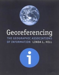
Georeferencing : the geographic associations of information
An introduction to the principles of unified georeferencing, which uses placename and geospatial referencing interchangeably across all types of information storage and retrieval systems.OCLC-licensed vendor bibliographic record.
- Edition
- -
- ISBN/ISSN
- 026208354X
- Collation
- 1 online resource (xiii, 260 pages) : illustrations, maps.
- Series Title
- Digital Libraries and Electronic Publishing
- Call Number
- 005 HIL g
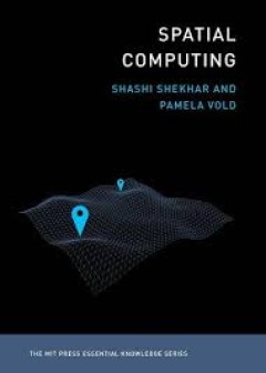
Spatial computing
An accessible guide to the ideas and technologies underlying such applications as GPS, Google Maps, Pok?emon Go , ride-sharing, driverless cars, and drone surveillance. Billions of people around the globe use various applications of spatial computing daily--by using a ride-sharing app, GPS, the e911 system, social media check-ins, even Pok?emon Go . Scientists and researchers use spatial comput…
- Edition
- -
- ISBN/ISSN
- 9780262356800
- Collation
- 1 online resource (256 pages).
- Series Title
- -
- Call Number
- -
Biogeographic Atlas Of the Southern Ocean
Famous lines from the diary of explorer Robert F. Scott, 17 January, 1912: “Great God! This is an awful place, and terrible enough for us to have labored to it without the reward of priority. Now for the run home, and a desperate struggle.” Scott and his companions would starve, freeze, and die ten weeks later in an Antarctic blizzard, disheartened by the knowledge that Roald Amundsen had …
- Edition
- -
- ISBN/ISSN
- 978-0-948277-28-3.
- Collation
- -
- Series Title
- -
- Call Number
- 910 BRO b

Violence in Nigeria Patterns and Trends
This book takes a quantitative look at ICT-generated event data to highlight current trends and issues in Nigeria at the local, state and national levels. Without emphasizing a specific policy or agenda, it provides context and perspective on the relative spatial-temporal distribution of conflict factors in Nigeria. The analysis of violence at state and local levels reveals a fractal pattern of…
- Edition
- -
- ISBN/ISSN
- 978-3-319-14935-6
- Collation
- -
- Series Title
- -
- Call Number
- -
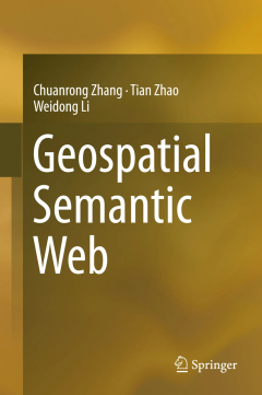
Geospatial Semantic Web
This book covers key issues related to Geospatial Semantic Web, including geospatial web services for spatial data interoperability; geospatial ontology for semantic interoperability; ontology creation, sharing, and integration; querying knowledge and information from heterogeneous data source; interfaces for Geospatial Semantic Web, VGI (Volunteered Geographic Information) and Geospatial Seman…
- Edition
- 1
- ISBN/ISSN
- 978-3-319-17800-4
- Collation
- VII, 194
- Series Title
- -
- Call Number
- 401.43 ZHA g
 Computer Science, Information & General Works
  Philosophy & Psychology
  Religion
  Social Sciences
  Language
  Pure Science
  Applied Sciences
  Art & Recreation
  Literature
  History & Geography